

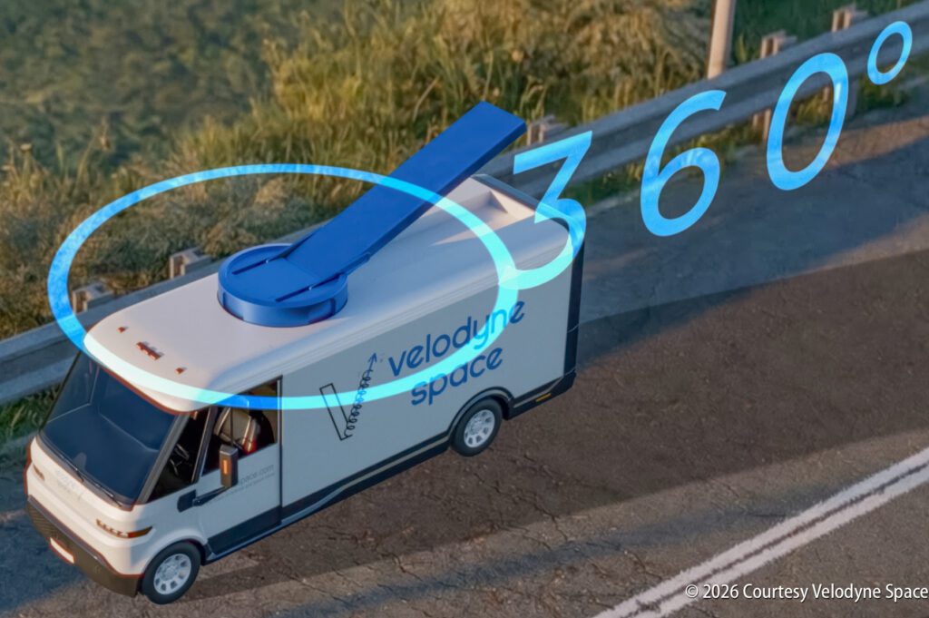
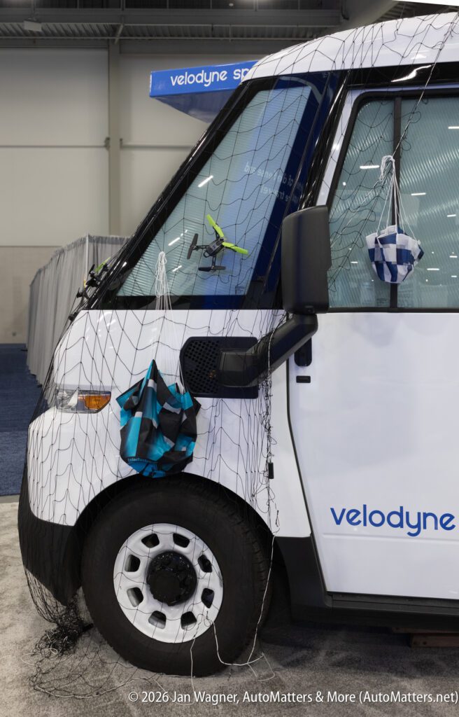
Velodyne Space vehicle-mounted drone-catching system at CES 2026
The unauthorized use of drones poses a growing national security and economic threat. Drones in the air can shut down airports, disrupt stadium events, smuggle contraband into prisons or threaten critical infrastructure. Hundreds of thousands of drone incursions are reported annually. Airport shutdowns alone can cost hundreds of millions of dollars per day.
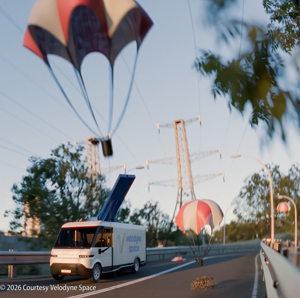
To meet the growing challenge of drone threats, Velodyne Space has introduced a non-destructive drone-catching system, and presented it — complete with video of the system in operation, at CES 2026 — the Consumer Electronics Show.
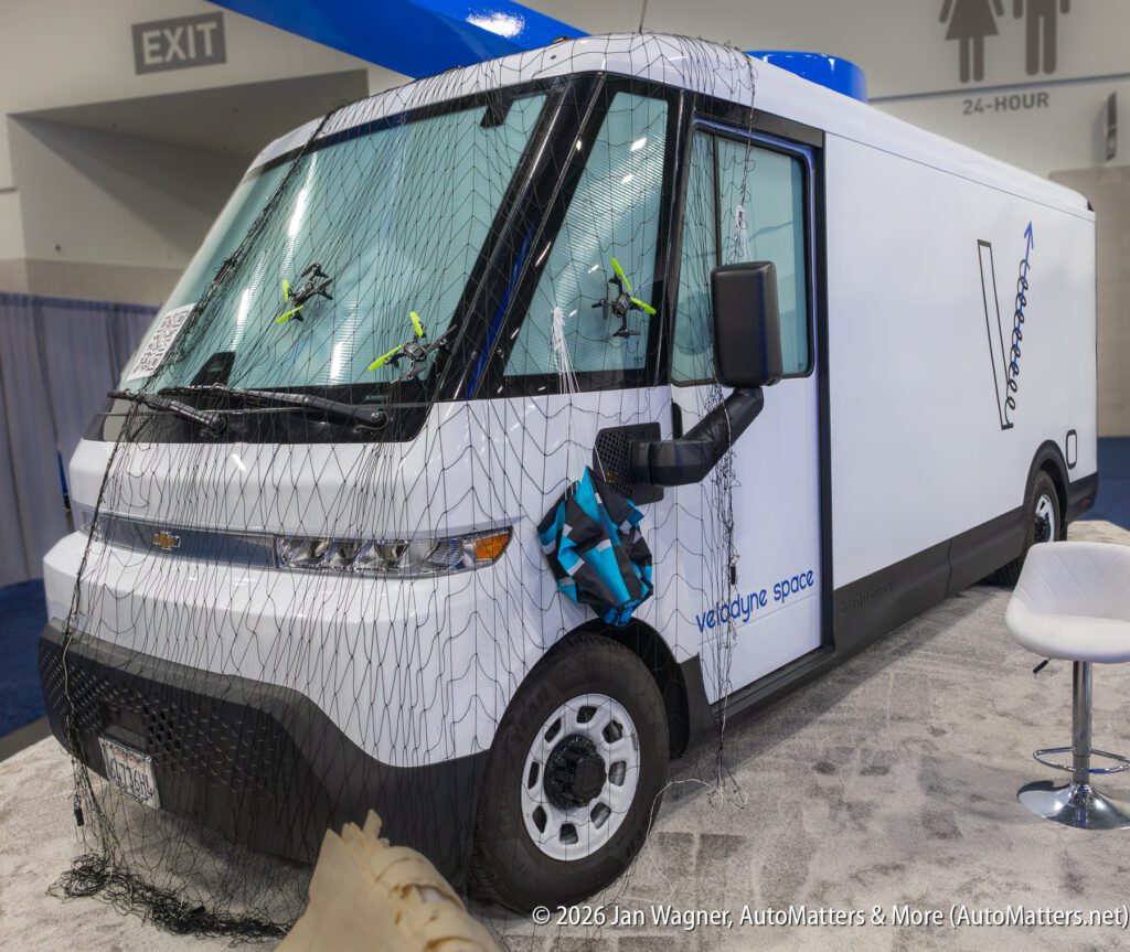
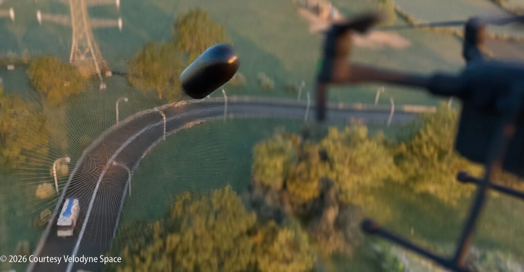
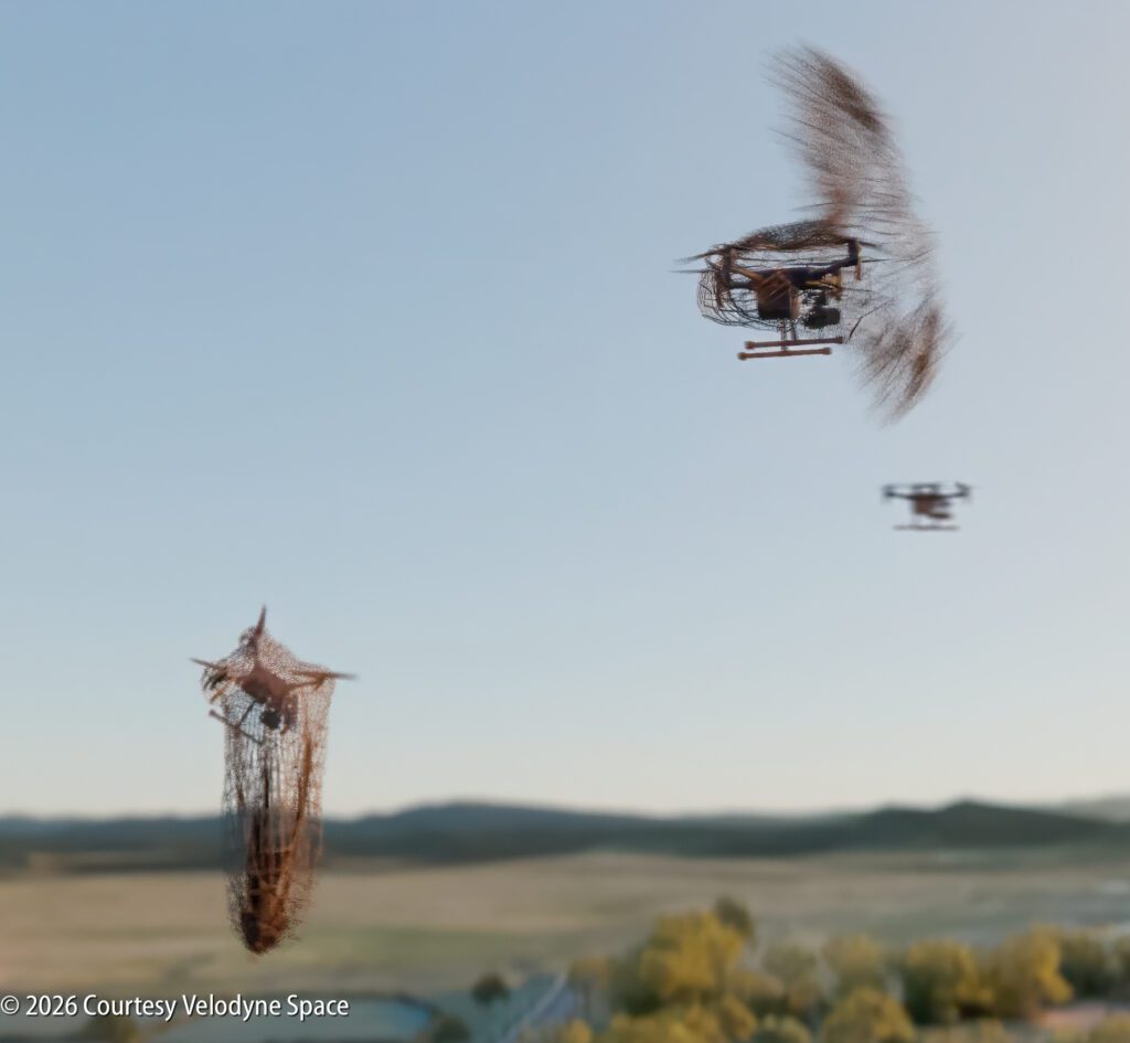
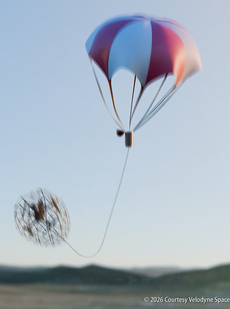
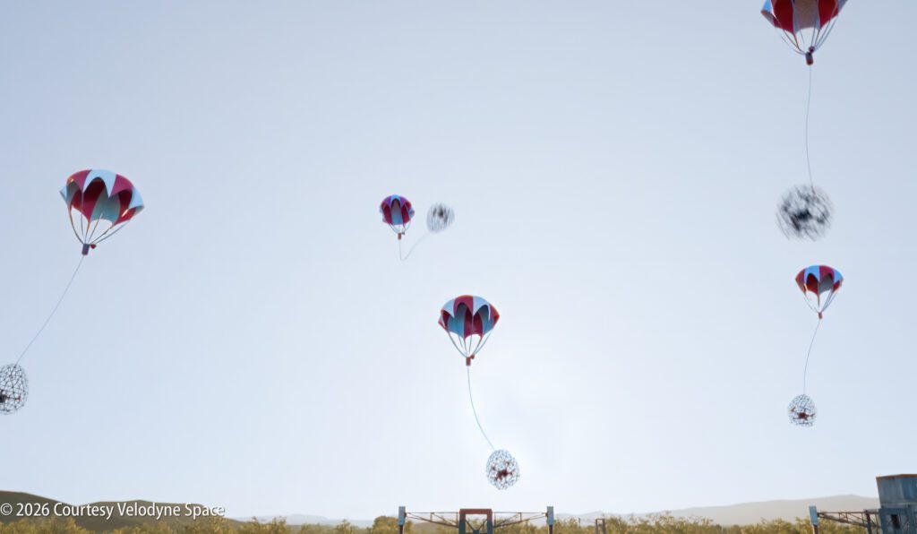
This drone-catching system is fascinating to watch. Basically, what this vehicle-mounted system does is it detects incoming drones, tracks them, targets them, fires net-bearing projectiles at them and gently lowers them by parachute, for softer landings without destroying them. Destroying a drone can cause fiery debris to fall on people or property. This system reduces risk to people and preserves evidence for forensic investigation.
This system does not rely on radio jamming or spoofing, it works against single drones and potential swarm scenarios, and its soft landing prioritizes public safety, making it safe use in populated areas.
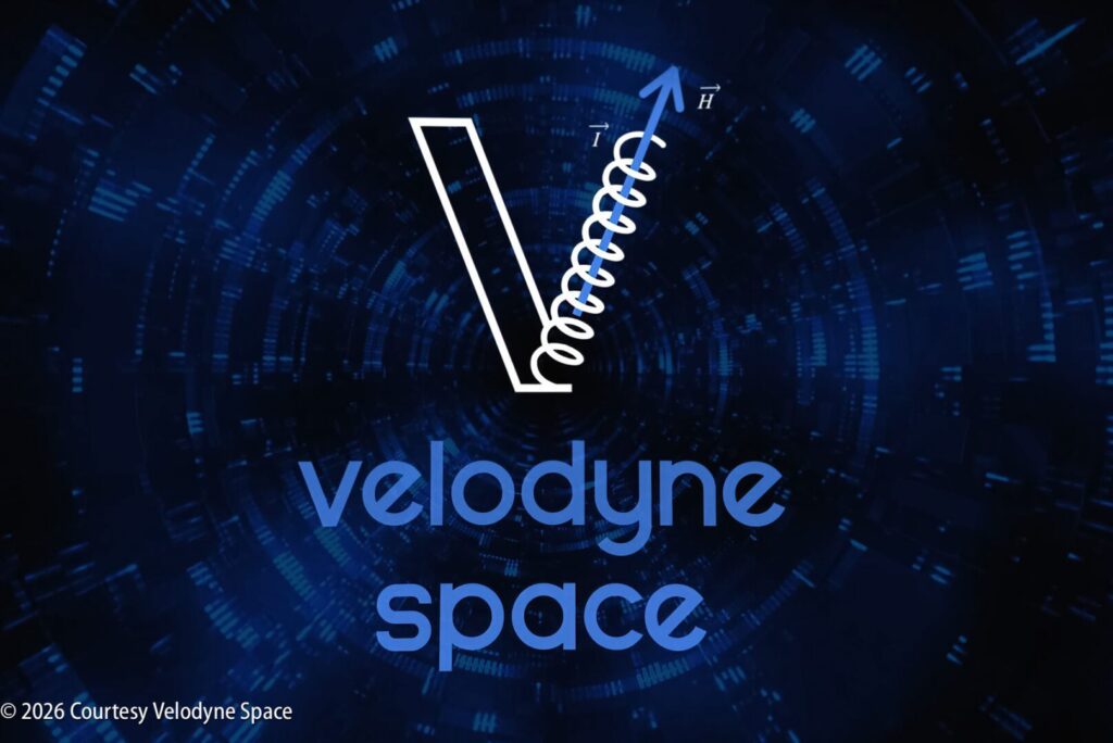
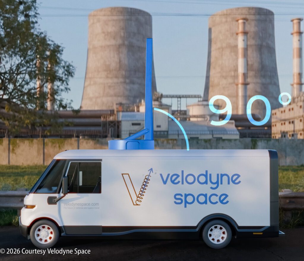
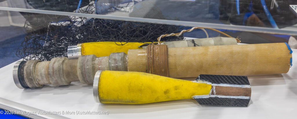
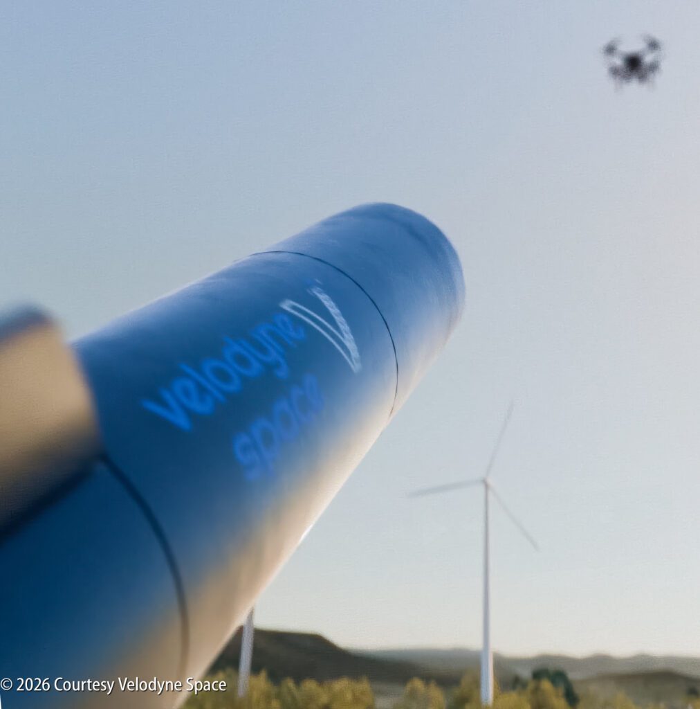
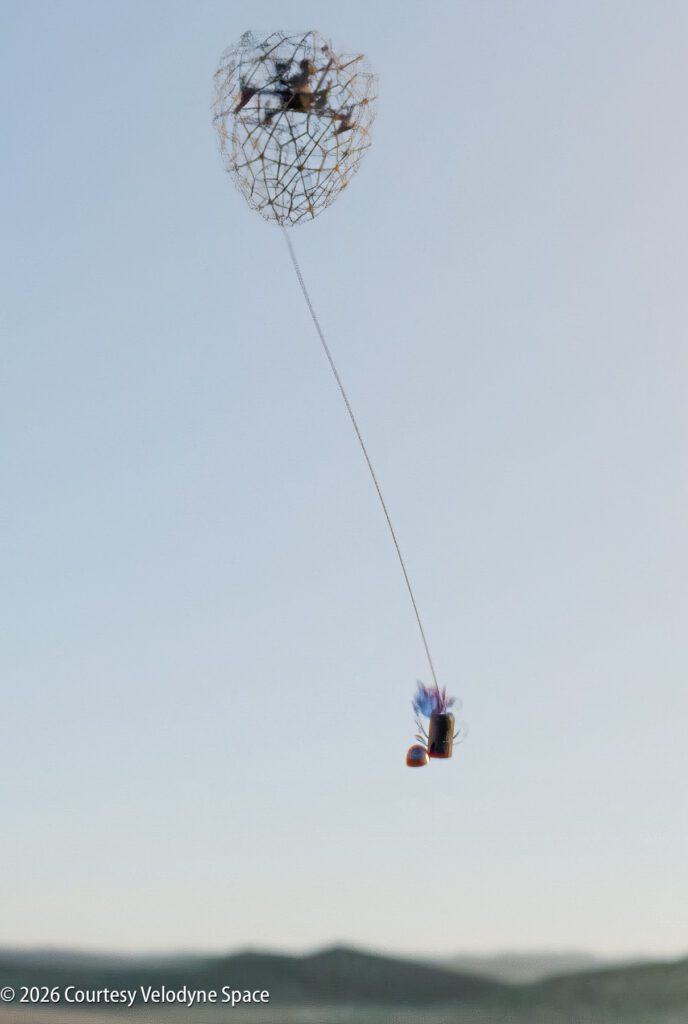
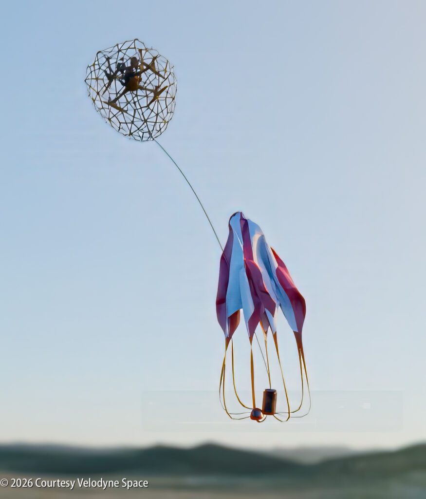
The system launches a net using a Magnetic Electronic Launch System (MEL). The net opens mid-air, entangles the drone and deploys a parachute so everything comes down safely.
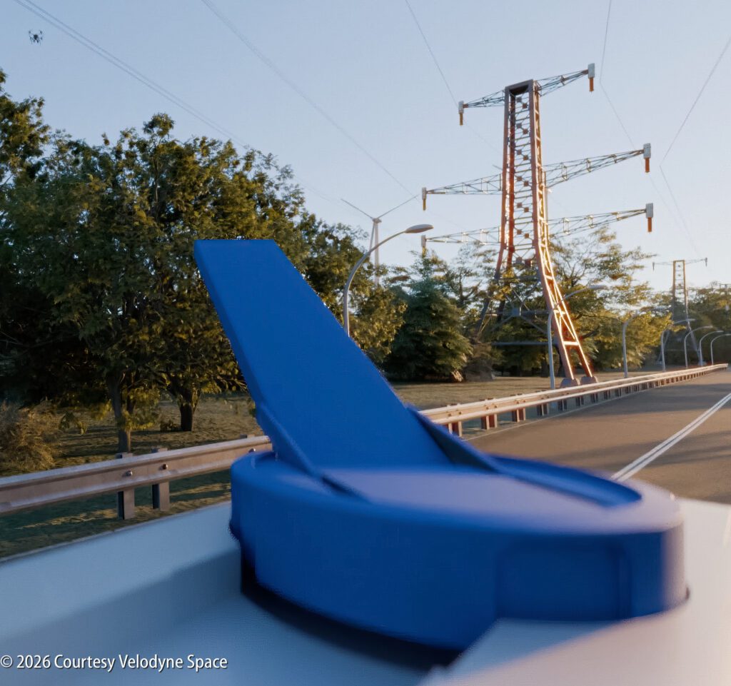
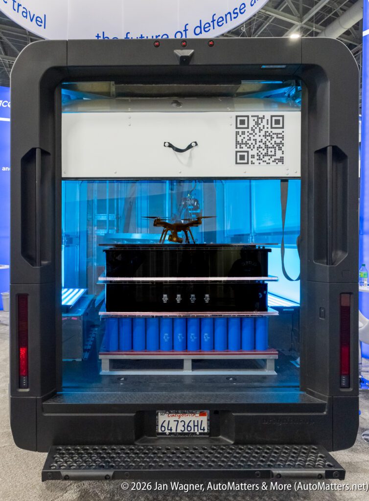
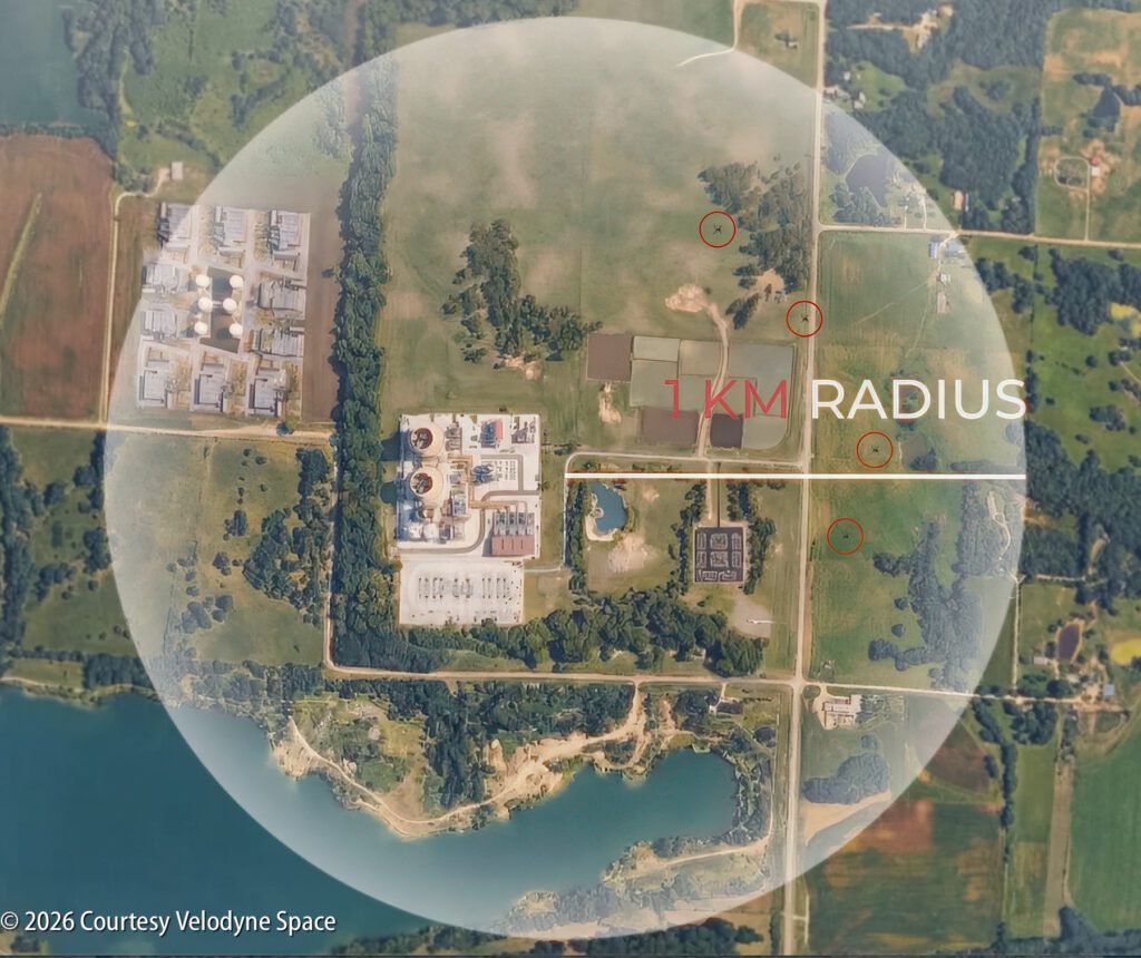
The Magnetic Electronic Launch System replaces traditional chemical rockets with clean, efficient technology. It uses coils and magnetic fields powered by capacitors to accelerate a projectile at near Mach 1 speeds. There is no physical rail, no explosive charge and minimal wear, ideal for fast relaunching and long-term use. The same Magnetic Electronic Launch System technology has been under development for space material launch applications for five years. The system draws energy from the vehicle’s 400V battery system to charge capacitor banks capable of rapid firing, up to 5 times per second. Its range is 1km.
To detect and catch incoming drones, the system combines cameras (for visual confirmation), lidar (for precise distance measurement), thermal imaging (for low visibility conditions) and AI-assisted object detection and tracking. All sensor data appears on a single display for the human operator, who always makes the final decision before engaging.
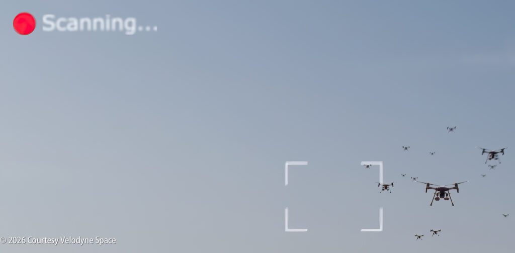
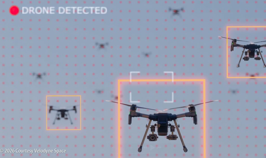
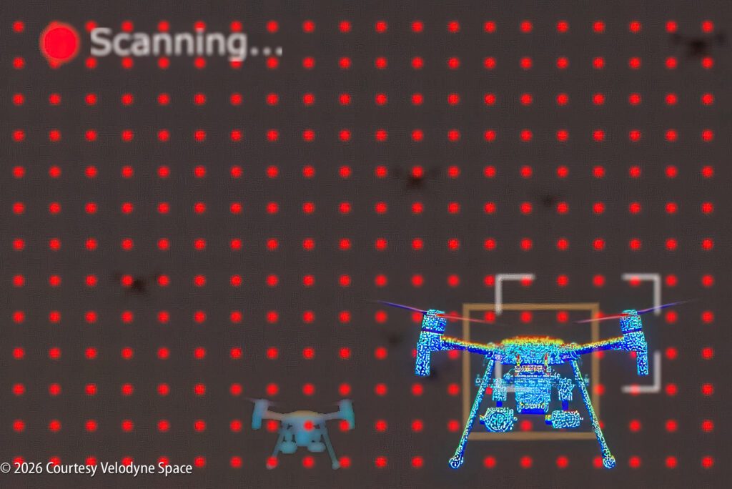
CamLidar detects and tracks drones with pin-point precision. AI differentiates the drone threat from birds, kites and other false targets. Lidar tracks the speed for accurate intervention. It calculates distance and automatically leads the target based on drone speed and direction, similar to how a shotgun hunter leads a moving target. The system is effective against fiber-optic controlled drones that cannot be jammed. It is immune to frequency-hopping.
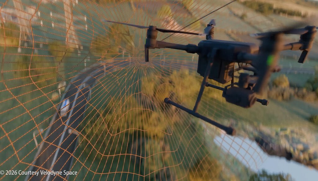
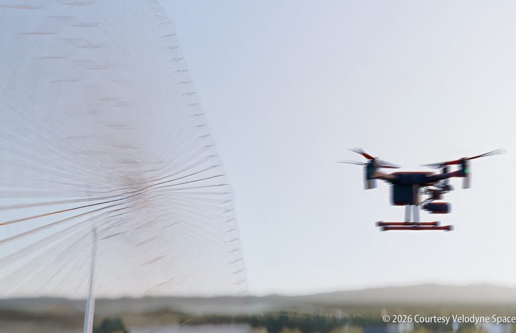
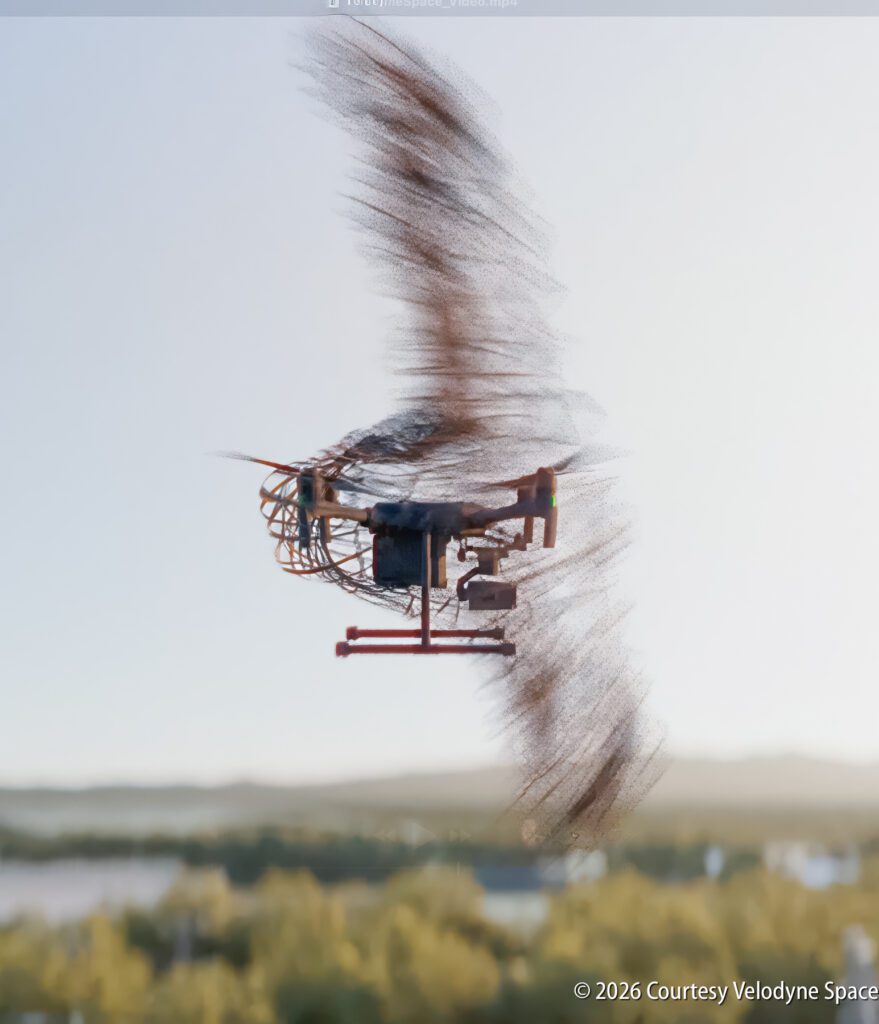
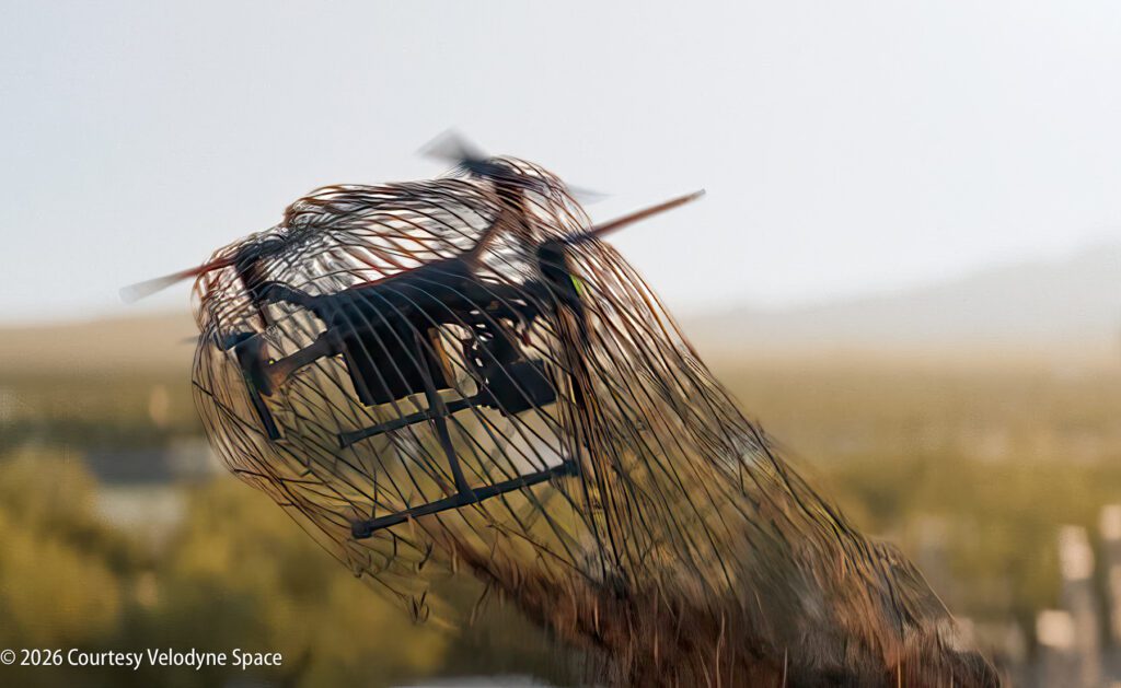
The drones descend toward a soft landing led by a parachute attached to the net, enabling safe recovery. This preserves evidence, leaving open the possibility to identify operators, intent and origin.
The electric four-wheel-drive van is designed for urban, rural and border environments. This system can be used around airports, stadiums, power plants, water treatment centers, correctional facilities, borders and other critical infrastructure.
The system reads FAA Remote ID broadcasts and cross-checks detected drones against the LAANCE database. Registered drones are avoided; unidentified drones are flagged for further evaluation.
David Hall is the inventor of CamLidar and MEL. He has been inventing for over 35 years, with an admirable record of success in design, prototyping and finished product delivery. Hall is widely recognized for his involvement in lidar technology for self-driving cars, having founded Velodyne Lidar. Hall’s sensor designs have been used in robotics, mapping, industrial automation and advanced navigation systems. Hall spurred the autonomous revolution, and currently holds more than 150 scientific patents, primarily revolving around sensor technologies and lidar systems.
Currently, drone engagement authority is restricted and evolving. This system is designed to operate only under proper authorization and keeps a human operator in the decision loop at all times. Planned testing will occur in remote, FAA-approved locations such as the Mojave Desert or Montana. There is a planned demonstration in Spring 2026. The company is currently taking orders, with delivery expected in late 2026.
For more information, visit https://www.velodynespace.com/.
To explore a wide variety of content dating back to 2002, with the most photos and the latest text, visit “AutoMatters & More” at https://automatters.net. Search by title or topic in the Search Bar in the middle of the Home Page, or click on the blue ‘years’ boxes and browse.
Jan, very interesting device. It “captures” drones unharmed so the operator can be traced.